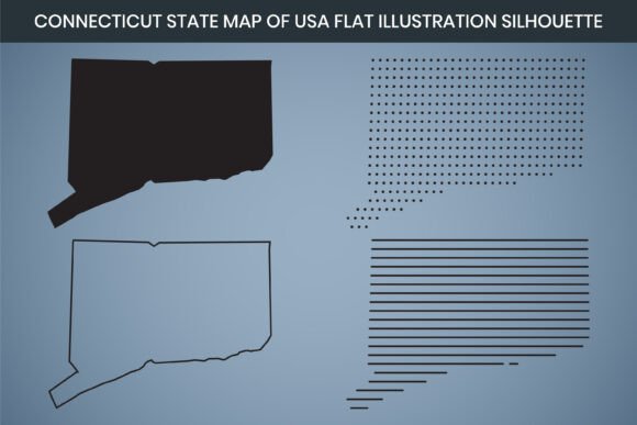
Connecticut State Hand Drawn Outline Map: A Versatile Design Resource for Professionals and Creatives
Finding the right map asset for a project often means settling for generic, low-resolution files that fail to capture the character of a state. Whether you are designing educational materials, crafting signage, or building a visual brand around local identity, a map needs to be both accurate and aesthetically flexible. The Connecticut State Hand Drawn Outline Map offers a solution that bridges the gap between artistic style and practical utility. This resource provides a clean, hand-rendered silhouette of Connecticut that works across multiple applications, from laser cutting to digital publishing.
Understanding the Connecticut State Hand Drawn Outline Map
At its core, this product is a collection of high-resolution map files centered on the outline of Connecticut. It is available in a range of formats—AI, SVG, EPS, DXF, PNG, and PDF—so you can use it regardless of your preferred software or hardware. The map is rendered at 3000 x 2000 pixels with 300 DPI resolution, ensuring crisp output whether you are printing at poster size or displaying on a screen. The hand-drawn style adds a subtle, approachable feel that distinguishes it from rigid, computer-generated outlines. This makes it especially appealing for projects where you want the map to feel warm, inviting, or handcrafted.
The file is fully editable in RGB color mode, and it is designed to be compatible with Canva for those who prefer a browser-based workflow. The inclusion of a print-ready PDF and PNG files means you can start using the map immediately without needing advanced design skills. For users who work with laser cutters or CNC machines, the DXF format provides the vector precision needed for cutting and engraving.
Who Benefits from This Design Resource
Different users approach state map files with different needs. A graphic designer might require a scalable vector that layers cleanly into a larger composition. An educator may need a printable map for a classroom activity or a geography lesson. A small business owner could use the outline to create custom coasters, wall art, or promotional materials that celebrate local pride. A hobbyist working with a laser cutter or vinyl cutter needs a file that translates smoothly into cut lines without extra cleanup work.
The Connecticut State Hand Drawn Outline Map addresses each of these scenarios by offering a single source file that works across platforms. Instead of searching for separate raster and vector versions, you get one set that covers both use cases. This saves time, reduces the risk of file incompatibility, and ensures that the design stays consistent whether you are printing, cutting, or publishing online.
Practical Applications and Real-World Outcomes
One of the most common challenges when working with state outlines is finding a file that is detailed enough to be recognizable but simple enough to remain functional. Too much detail can cause problems for laser cutters and plotters, while too little detail can make the map look generic. The hand-drawn style of this map strikes a useful balance. It includes enough contour to clearly read as Connecticut, with a natural, flowing line that works well for both digital and physical production.
For laser cutting and engraving, the DXF format allows you to import the outline directly into software like LightBurn or LaserGRBL. The 300 DPI resolution ensures that fine details in the coastline and borders remain sharp after cutting. You can scale the outline to fit coasters, keychains, wooden signs, or decorative plaques without losing clarity. Because the file is fully editable, you can also adjust the stroke weight or combine the outline with text and other graphics before sending it to the machine.
For print projects, the included PDF and PNG files are ready to use. The 3000 x 2000 pixel dimension gives you plenty of resolution for large-format printing. Whether you are producing a poster for a community center, a brochure for a local tourism campaign, or a handout for a geography class, the map holds up well at scale. The RGB color mode also makes it easy to recolor the map to match your brand palette without worrying about color shifts between screen and print.
For digital content, the SVG and AI files allow you to embed the map directly into websites, presentations, or social media graphics. The hand-drawn style adds a distinctive visual identity that sets your content apart from stock clip art. You can combine the outline with infographic elements, icons, or typography to create educational diagrams, location maps, or data visualizations that feel cohesive and professional.
How Different Users Can Approach the File
If you are a teacher or homeschooling parent, the printable PDF gives you a ready-to-use outline for classroom exercises. Students can label cities, rivers, and neighboring states directly on the map. The clean silhouette also works well for art projects where children color or decorate the state outline. Having a high-resolution file means you can print multiple copies without degradation, and you can reuse the file year after year.
If you are a graphic designer, you will likely start with the AI or SVG file. These vector formats allow you to manipulate every point and curve in the outline. You can adjust the stroke style, fill the shape with a gradient or pattern, or use it as a clipping mask for a photo of Connecticut scenery. The editable nature of the file means you are not locked into a single design direction. You can repurpose the same outline for different clients or projects by simply changing the styling.
If you are a small business owner or entrepreneur, you can use the map file to create products that appeal to local customers. Consider printing the outline on tote bags, t-shirts, mugs, or stickers. The DXF format also supports precision cutting for vinyl decals. You can offer custom signage for local businesses, real estate offices, or community organizations that want to highlight their Connecticut roots. Because the file is fully editable, you can add your company name, a tagline, or a specific location marker directly onto the map.
If you are a hobbyist working with a CNC router or laser cutter, the DXF file is your primary tool. You can import it into your cutting software, adjust the scale, and run a test cut on scrap material before committing to your final piece. The hand-drawn linework tends to engrave nicely, producing a result that looks more organic than a strict geometric outline. This can be especially appealing for rustic or handmade-style products.
Recommendations for Getting the Most Out of Your Map Files
Before using the file in a production workflow, take a few moments to inspect the outline in your chosen software. While the file is pre-optimized, checking for any overlapping nodes or stray points can save you time later, especially if you are cutting material. If you plan to use the map in Canva, simply upload the PNG or the SVG file. The RGB color mode ensures that colors display accurately in the browser, and you can add text, shapes, and other elements directly on top of the outline.
If you are printing the map, consider testing a small version first to confirm the scale and color accuracy. The 300 DPI resolution gives you a lot of flexibility, but different printers handle line art differently. A test print lets you see whether the stroke weight needs adjustment for your specific printer. Similarly, if you are laser cutting, run a test engrave on a small piece of the same material to confirm that the power and speed settings produce the look you want.
For users who want to modify the outline, the AI and EPS formats give you the most control. You can add internal details like county borders, major highways, or city markers if your project requires more than just the state shape. Because the file is fully editable, you can also merge the outline with other design elements without worrying about format compatibility. Keep a backup of the original file in case you need to revert to the clean outline later.
Final Considerations for Choosing a State Outline Map
The Connecticut State Hand Drawn Outline Map stands out because it combines artistic style with practical versatility. It eliminates the need to source separate files for print, digital, and cutting applications. The variety of included formats means you are covered whether you work in Adobe Creative Suite, Canva, or a laser cutter's native software. The hand-drawn aesthetic gives your project a unique visual voice that feels personal rather than mass-produced.
When you invest in a map file, you want something that works out of the box but also adapts to your specific needs. This resource delivers on both fronts. It respects the boundaries of Connecticut's geography while giving you the freedom to style it however your project demands. Whether you are creating educational handouts, crafting a product line, or building a brand around local identity, this map provides a solid foundation that you can rely on from start to finish.