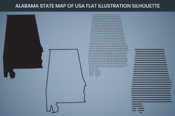
Alabama State Hand Drawn Outline Map USA
If you have ever searched for a clean, flexible map of Alabama for a design project, educational handout, or marketing piece, you have likely come across digital map assets described as hand drawn outline maps. The Alabama State Hand Drawn Outline Map USA is one such asset, but like any specialized design file, it is easy to misunderstand what you are getting or how to use it well. This article walks through what this map set actually includes, where people tend to go wrong, and how to make sure you choose and use it in a way that saves time, preserves quality, and delivers exactly what your project needs.
What the Alabama State Hand Drawn Outline Map USA Actually Offers
At its core, this product is a digital map asset that provides the outline of Alabama in a hand drawn style. It is not a simple screenshot or low-resolution image. The set includes files at 3000 x 2000 pixel dimensions with 300 DPI resolution, which means it is built for both on-screen work and professional print output. The hand drawn aesthetic gives it a more natural, sketch-like feel compared to rigid, computer-generated state outlines. This makes it attractive for posters, infographics, educational materials, branding projects, and social media graphics where a softer, more organic look is preferred.
The package includes multiple file formats: AI, SVG, EPS, DXF, PNG, and PDF. It also comes with a laser cut design capability and is fully editable in Canva. The RGB color mode ensures the colors display correctly on digital screens, while the print-ready PDF makes it straightforward to send to a printer without additional adjustments. Whether you are a freelancer building a state-themed infographic, a small business owner creating local marketing materials, or an educator preparing a geography worksheet, this map gives you a flexible starting point.
Where many people get tripped up is assuming that because the map looks simple, any file format will do, or that editing it requires no technical knowledge. Those assumptions can lead to frustration, wasted time, and output that looks nothing like what you imagined.
Mistake 1: Grabbing the Wrong File Format for Your Workflow
The most common misstep happens right at the start: picking a file format that does not match how you intend to use the map. The Alabama State Hand Drawn Outline Map USA comes with several formats, but they are not interchangeable for every task. Using the PNG when you need full vector scalability, or trying to open the AI file in a program that only handles raster images, will cause problems.
- PNG is a raster format. It works well for quick digital use, but if you enlarge it beyond its native resolution, it becomes pixelated. For print projects or large displays, a PNG alone will limit your quality.
- AI, SVG, and EPS are vector formats. They scale infinitely without losing sharpness. These are the right choices if you need to resize the map for a billboard, a banner, or a business card.
- DXF is designed for CAD and laser cutting. If you plan to cut the map out of wood or acrylic, this is the format you need. Using a PNG for laser cutting will not work.
- PDF is a reliable print-ready format. It preserves layout and resolution, making it ideal for sending to a professional printer or using in a layout application like InDesign.
- Canva compatibility means you can upload the SVG or PNG directly into Canva and edit it there. This is a huge time-saver for non-designers, but only if you choose the editable format.
How to avoid this mistake: Before you download, consider your end use. If you need to scale the map across different sizes, use a vector format. If you are printing at a fixed size, the PDF or high-resolution PNG will serve you well. If you plan to edit inside Canva, confirm the file type that works with your Canva plan. Taking two minutes to match the format to your workflow prevents rework and disappointment.
Mistake 2: Overlooking Resolution and DPI Requirements for Print
The 300 DPI resolution in this map set is excellent for print, but not everyone checks whether their project actually requires that level of detail. Some people use the 300 DPI file for digital-only projects where 72 DPI would be sufficient, unnecessarily bloating file size and slowing down load times. Others assume that because the file is marked as high resolution, they can enlarge it indefinitely – but even at 3000 x 2000 pixels, there is a physical limit to how large you can print before quality degrades.
As a general guideline, 300 DPI is standard for professional print. At 3000 x 2000 pixels, you can print the map at roughly 10 x 6.7 inches at full quality. If you need a larger print, you must use the vector format so the outline scales without pixelation. The hand drawn style can look wonderful on a poster, but only if you respect the resolution limits of the raster files.
How to avoid this mistake: Determine the final print size before you start. If your output is larger than the native raster dimensions, switch to the SVG or AI file. For digital use, you can safely downsample the file to 72 or 150 DPI to keep file sizes manageable. Keeping a master vector copy ensures you have a future-proof source file for any size need.
Mistake 3: Ignoring the Hand Drawn Aesthetic in Professional Contexts
The hand drawn look is part of this map’s appeal, but it is not right for every project. Some buyers grab the Alabama State Hand Drawn Outline Map USA because they need a state outline, without considering whether the sketch style fits their brand or audience. A hand drawn map might look out of place on a formal legal document, a corporate annual report, or a government website. It works beautifully for classrooms, creative blogs, travel guides, craft projects, and small business logos with a rustic or artisanal feel.
Mismatching the style to the context can make your work look unprofessional or careless. On the other hand, using a sterile, computer-generated outline for a creative project can make it feel flat and uninspired.
How to avoid this mistake: Look at your overall design direction. If your brand or project leans toward the organic, handcrafted, or educational, the hand drawn style is a strong choice. If you need a neutral, clinical, or ultra-modern look, consider a more standard vector outline. The map asset is a tool, not a universal solution. Let your project’s tone guide the choice.
Mistake 4: Trying to Edit Without Understanding Vector Basics
One of the selling points of this map is that it is fully editable, especially in Canva. But editable does not mean instantly intuitive. Beginners sometimes open the SVG or AI file and expect to modify the outline as easily as typing text. Changing the color of the map, adding text labels, or combining it with other graphics requires basic knowledge of layers, grouping, and path editing.
For example, if you want to highlight specific regions or add a pattern inside the state outline, you need to know how to work with closed paths in vector software. Without that knowledge, you might accidentally break the outline, create unwanted gaps, or lose the hand drawn quality.
How to avoid this mistake: If you are new to vector editing, start with Canva. The map’s Canva compatibility means you can drag it in, resize it, change its color, and overlay text without touching complex software. If you need advanced edits, take a few minutes to learn the basics of layers and path editing in Illustrator or Affinity Designer. There are many free tutorials that cover exactly these skills. Investing a small amount of learning time upfront saves you from corrupted files and messy results.
Mistake 5: Forgetting About Licensing and Usage Rights
Digital map assets often come with specific licensing terms. Some allow commercial use, others restrict it. Some let you use the map in products you sell, while others only permit personal projects. The Alabama State Hand Drawn Outline Map USA may include broad usage rights, but you should always verify before using it in a client deliverable, a product for sale, or a large-scale marketing campaign.
Assuming that a purchased file automatically grants full commercial rights is a common oversight. This can lead to legal complications, especially if you are a freelancer or small business owner who relies on clean licensing. Even if the seller allows commercial use, you may need to provide attribution or adhere to limits on print runs.
How to avoid this mistake: Read the license terms before downloading. If the product page does not clearly state usage rights, contact the seller. Keep a copy of the license in your project files for reference. When in doubt, choose assets with clearly stated commercial allowances. This habit protects your work and your reputation.
Mistake 6: Not Testing the Map in Your Actual Workflow
Even when you pick the right format and understand the style, the final test is whether the map behaves as expected inside your specific tools. Some users download the AI file only to find that their older version of Illustrator does not support the file. Others find that the SVG renders differently in Canva than it does in a browser. The laser cut DXF may need scaling adjustments depending on your cutting machine’s software.
These issues are not flaws in the product; they are natural differences between software environments. But they can cause delays and frustration if discovered mid-project.
How to avoid this mistake: Do a quick test run as soon as you download the files. Open each format you plan to use in your actual software. Check that colors display correctly, that the outline remains smooth, and that no unexpected artifacts appear. If you plan to cut the map with a laser, run a small test cut on scrap material first. A five-minute test can save hours of rework and material waste.
What to Check Before You Buy or Use a State Hand Drawn Map
Before you finalize your purchase or start a project with the Alabama State Hand Drawn Outline Map USA, run through this short checklist:
- Format compatibility: Does your software support the file formats included? If you only have access to Canva, confirm that the SVG or PNG works there.
- Resolution for print: Is 300 DPI sufficient for your print size? If you need a larger print, do you have vector formats available?
- Style fit: Does the hand drawn look align with your brand, audience, and project tone?
- Editing confidence: Do you know how to change colors, add text, or combine this map with other graphics? If not, do you have time to learn or access to help?
- Licensing clarity: Are you allowed to use this map in your specific project, especially if it is commercial or client-facing?
- Test results: Have you opened the file in your actual workflow and confirmed it works as expected?
Making the Most of the Hand Drawn Map
When used thoughtfully, the Alabama State Hand Drawn Outline Map USA becomes a versatile asset that elevates your design without adding unnecessary complexity. Use it to build custom infographics about Alabama’s geography, population centers, or historical landmarks. Incorporate it into a branded travel guide or a locally themed promotional piece. Layer it with typography for a clean poster. The hand drawn quality adds warmth that a generic outline cannot match.
For educators, this map works well in worksheets, classroom posters, and digital learning materials. The print-ready PDF saves preparation time, while the editable vector files allow you to customize labels or add lesson-specific content. Small business owners can use it for logos, signage, or packaging that highlights local pride. Freelancers and designers will appreciate having a high-quality source file that adapts to client needs without starting from scratch each time.
The key is to approach the map as what it is: a well-crafted digital asset that rewards attention to detail. Choose the right format, respect its resolution limits, match its style to your project, and take a few minutes to test and learn. That small investment of care makes the difference between a file that sits unused and one that becomes a reliable part of your creative toolkit.